I saw this documentary as part of the 2014 London Palestine Film Festival, followed by a talk with Eyal Weizman, the plucky architect who narrates the film. I learned a lot from his book Hollow Land: Israel’s Architecture of Occupation, for its critical overview of the slow, mundane, pre-meditated way that the occupation of Palestine has been orchestrated over time. The brief documentary, directed by Ana Naomi de Sousa, addresses and visualizes the more striking elements of the book. For example, Israel’s use of “Jerusalem stone” in building housing units in the settlements surrounding Jerusalem, to evoke the old city center of the iconic city. The architect knows these buildings are mostly made of concrete, the outside layer merely a facade. (An added tidbit from the book is that this stone is actually mined and manufactured in the West Bank.) The film explores how “Architecture is used by architects…as a weapon.”
Tag: west bank
A Showcase of Extremes: Shuhada Street and the Logic of Occupation
Hebron, the largest Palestinian urban center in the West Bank, is increasingly known as a contested and embattled space. It is unique in the occupied Palestinian territories because Israeli settlements have been established inside the city. Mundane violence and segregation are evident here, most starkly culminating in Shuhada Street, once a bustling Palestinian thoroughfare, now off-limits to Palestinians. Numerous international organizations have set up shop here to document daily human rights abuses, though they’ve had little success in holding settlers and Israel accountable to their policies. There are many tours one can take while visiting Hebron, which is almost always recommended to visiting internationals itching to get a feel for “the situation,” at odds with all liberal sentiments. These kinds of tours often use Hebron as an example of a particularly dire situation, where Israeli settlers have taken things to the extreme. And extreme examples abound, such as when the Israeli military recently detained a 5-year old Palestinian. But is Hebron an exception to the rule?
 Views of Hebron. Spot the military lookout.
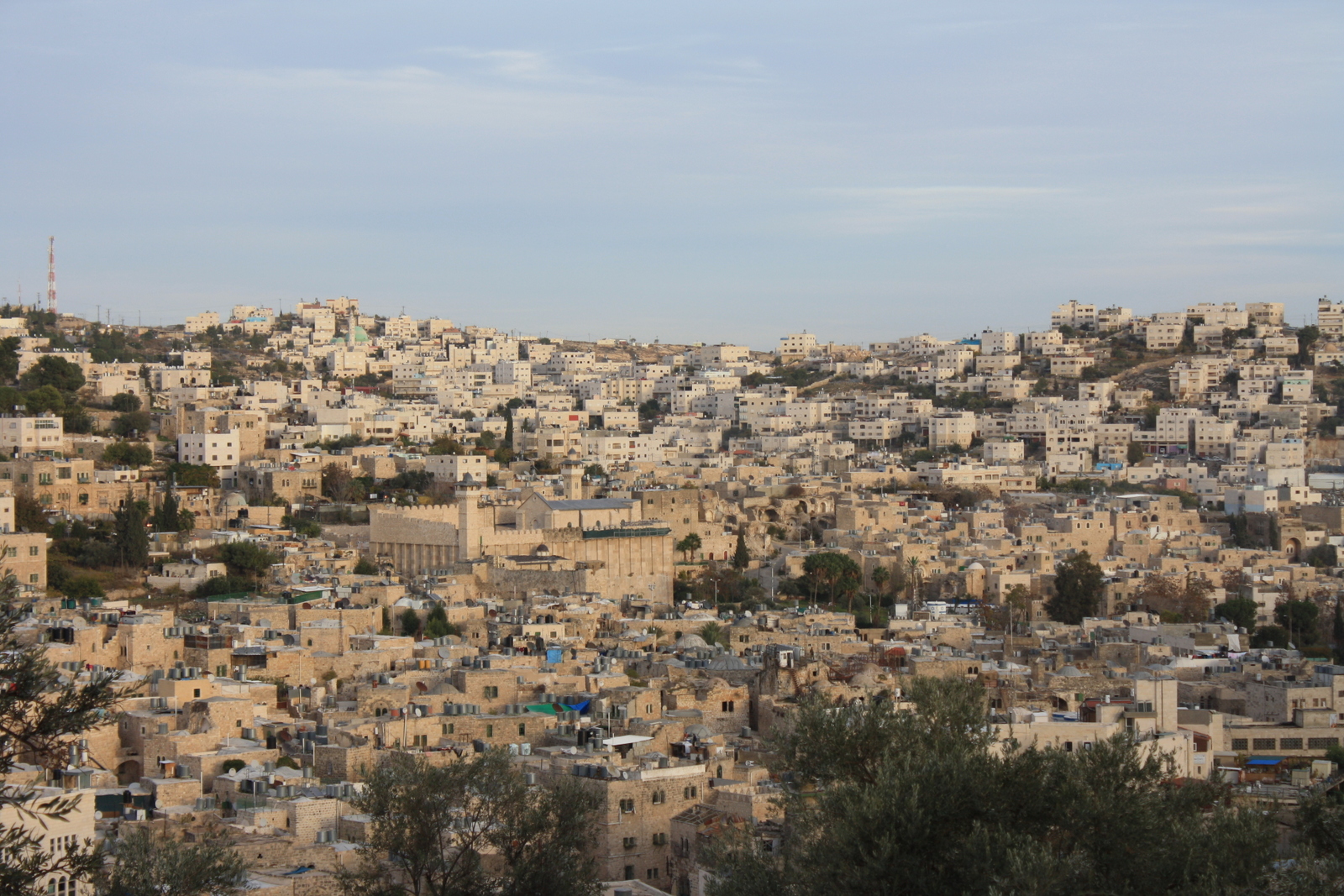
Like so many other Israeli settlements throughout the West Bank, settlements in Hebron’s city center were established with assistance from the Israeli army, in the 1970s. Currently there are about 500 settlers in Hebron, with about 2,500 to 4,000 Israeli soldiers stationed around the area to protect them. In 1994, New York-born Israeli settler Baruch Goldstein massacred 29 praying Palestinians at the Tomb of the Patriarchs. This is when Israel began limiting the movement of Palestinians in Hebron, supposedly to increase security (ha, ha). With the Oslo Accords, Hebron was divided into zones indicating various degrees of Israeli and Palestinian control, mirroring the division of the entire West Bank into Areas A, B, and C. Shuhada Street was completely closed off to Palestinians (except for residents of the street, but even they are limited in their access) with the outbreak of the Second Intifada in 2000.
According to B’Tselem, 304 Palestinian-owned shops and warehouses along the street were shut down, and Israel even turned the central bus station into an army base. This has completely stifled the Palestinian economy in this area, which is now known by many as a ghost town.
I have visited Hebron on three occasions. These photos are mainly from my second visit, in December of 2012, when I visited with two Americans, a Canadian, and a Palestinian. We arrived in the afternoon as the sun was setting.

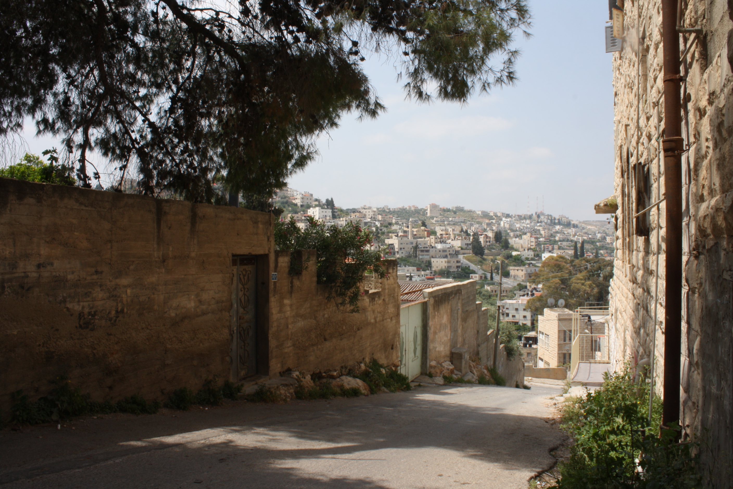
Palestinian children play near their home on a route frequented by settlers descending toward Shuhada Street. A bit further down the hill, out of view, is an Israeli soldier stationed at a lookout to ensure the safe passage of settlers.

An abandoned car. I haven’t been able to verify this, but my guess is the painted signs on the post demarcate the safe route for settlers.

Walking down Shuhada street. Since Palestinians who do not have residency here are not allowed to walk down this street, our Palestinian friend had to leave us and loop around to meet us on the other side. We passed store after store that was empty and boarded up. The street is eerily quiet besides the occasional passersby, though we felt utterly exposed and watched.
Continue reading “A Showcase of Extremes: Shuhada Street and the Logic of Occupation”
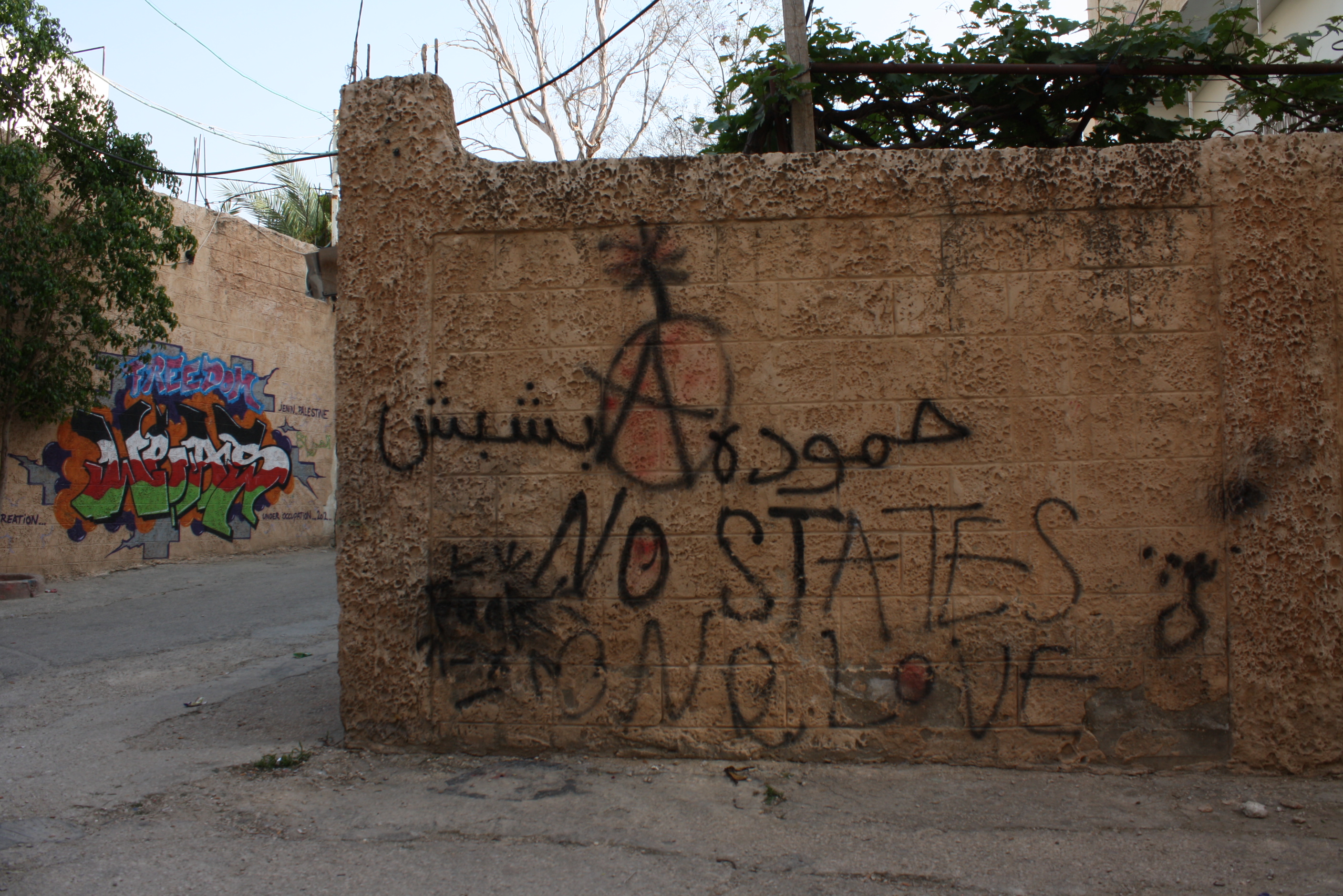
Jenin 13 April 2013


Why does Israel occupy Palestine?
It’s not a question to be taken for granted. If I had to give a short answer, I might say that Israel continues its occupation for land and resources—that it engages in what it knows to be a doomed “peace process” in order to eventually gain control over all of historic Palestine, “from the river to the sea”. At least, based on its actions, this is what Israel appears to be trying to do.
But there are continual and obvious contradictions in this idea. It is widely recognized among people educated in this topic that the longer Israel continues its occupation, the more it continues to build settlements throughout the West Bank along with infrastructure to serve those settlements, the closer it will come to having to deal with the 4 million+ Palestinians that inhabit the same space. Israel exhibits two conflicting desires: that for territory and that for a majority Jewish state. If Israel gains control over the entirety of historic Palestine, it will paradoxically lose its Jewish majority and thus its identity as a Jewish state.
So then how do we explain the current system? I recently read The Political Economy of Israel’s Occupation: Repression Beyond Exploitation, written by Israeli academic Shir Hever. I outline here some of the theories he describes that can be applied to the occupation of Palestinian land.
A great video of Hever speaking at King’s College London. He does not address the theorists discussed below in the video but his talk summarizes the main points of his book.
Continue reading “Why does Israel occupy Palestine?”
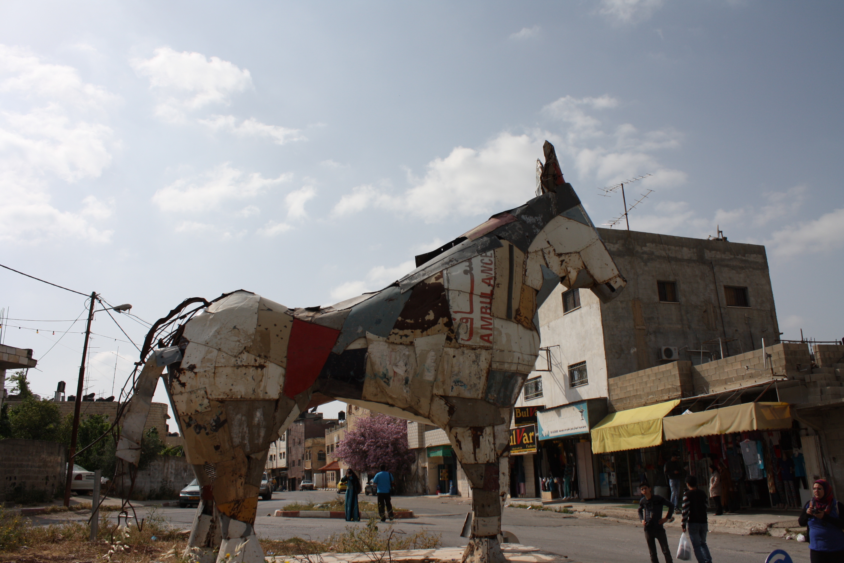
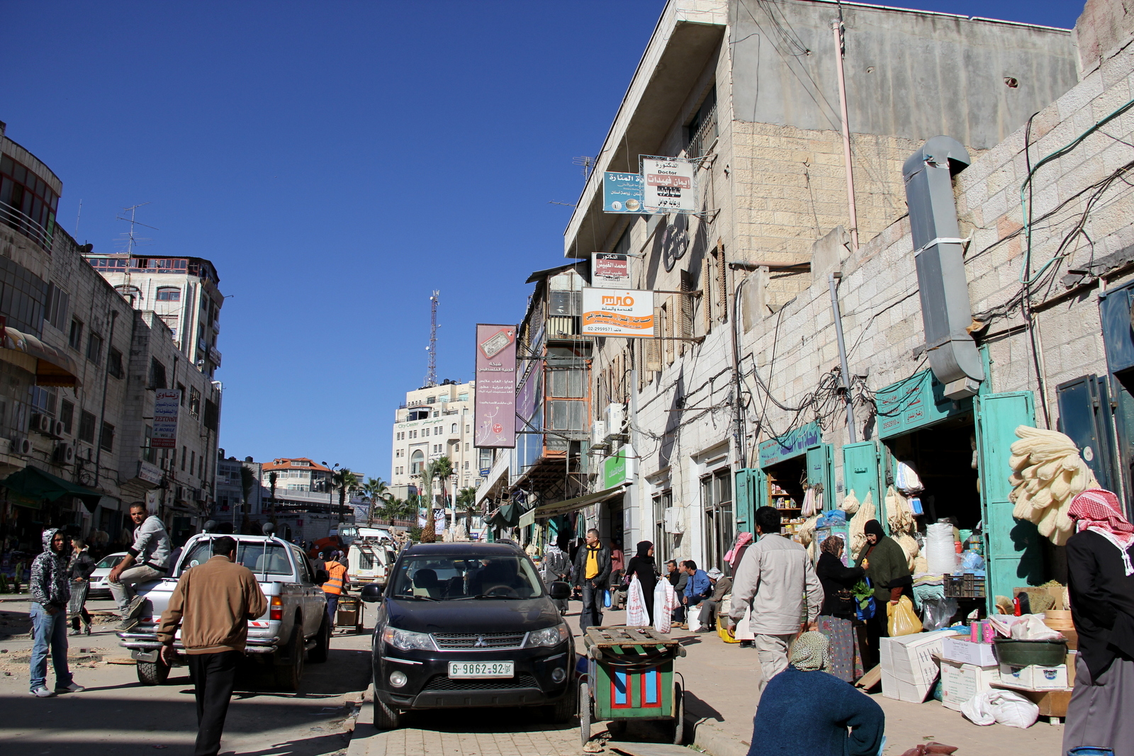
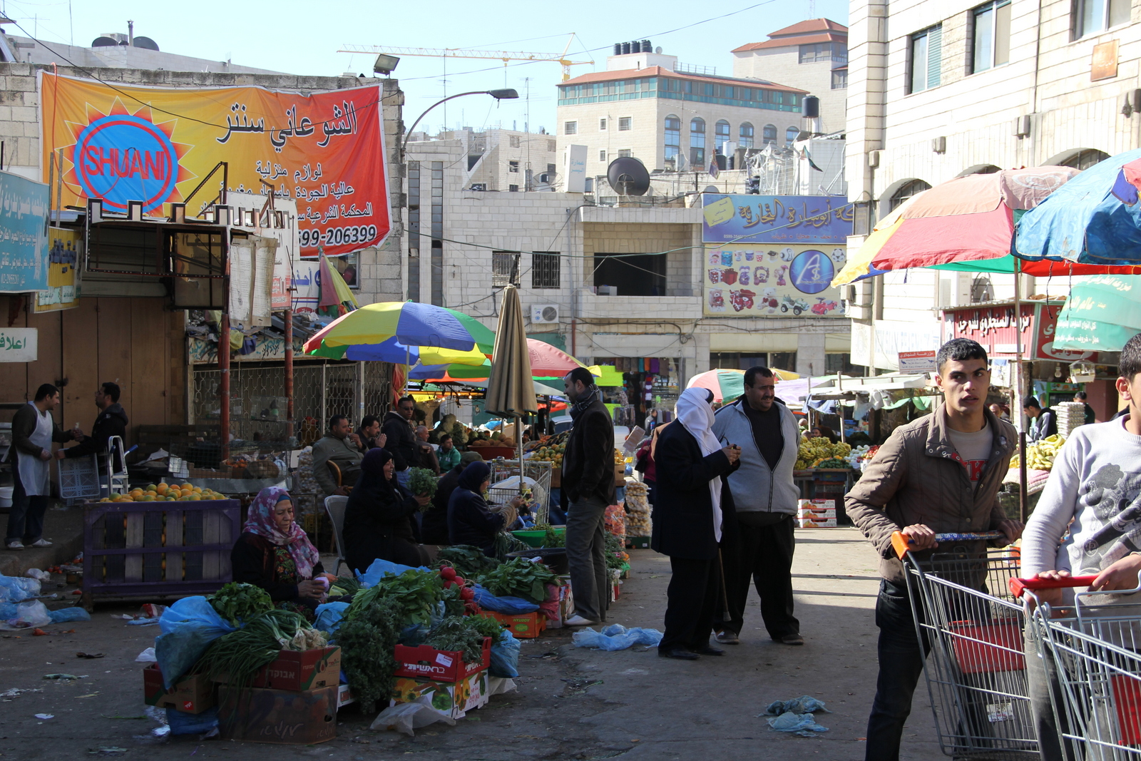
Ramallah November 2012
Around the central Hisbeh market.


Little Boxes
According to Israeli human rights group B’Tselem,* there are about 124 Israeli settlements in the occupied West Bank. In addition to this are around 100 informal “outposts.” All settlements are deemed illegal under international law, including all outposts, though unlike settlements, most outposts are not officially sanctioned by the Israeli government (key word: “officially”). There are many incentives for Israelis to move to settlements: though some move because they feel they are fulfilling a religious or nationalistic destiny, others are given financial incentives either directly by government bodies or because they simply cannot afford to live in cities like Tel Aviv or Jerusalem.
You can see settlements peppered throughout the West Bank (which is presumed to be under control of the Palestinian Authority, though you can see this is clearly not the case) on this map. The following pictures were all taken in the mid and northern West Bank, near Ramallah and up toward the Palestinian town of Nablus.

The settlement of Ofra, not too far north of Ramallah. Not all settlement houses look like carbon copies of each other, but these are particularly neat and uniform.

A nearby lookout point with views of the area. This sign is supposed to roughly show the location of nearby settlements. The text at the bottom asks, “Can you see the holy temple?” referring to the third and final temple that should theoretically, under Judaism, be built on the present-day Temple Mount in Jerusalem. Just behind the sign, you can see the informal caravans and structures that form the outpost called Amona.

Inside Ofra. The neat carbon-copy houses up close. I felt I could be in any number of suburban neighborhoods in the US. The streets were eerily quiet but for the occasional car or child on a bicycle.

A sign for the settlement of Kfar Tapuach (literally, “Appleville”), just south of Nablus. Fruit seems to be a recurring symbol on this day, as in one settlement, an over-sized grape statue graced a small roundabout near the entrance gate.

Kabir (“big” in arabic) Mountain

Palestinian village on the outskirts of Nablus.
West Bank: Access and Closure Map
The following map, updated yearly by the UN Office for the Coordination of Humanitarian Affairs (OCHA) is ubiquitous among West Bank NGOs. The map, one of the few detailed ones in existence, shows various movement and access restrictions throughout the Palestinian territory: settlements, checkpoints, Israeli-only roads, the construction of the Separation Wall, etc. Purplish blobs are Israeli settlements, and are visibly peppered throughout. Perhaps most striking are the colors signifying Areas A, B, and C–the three zones established under the Oslo Accords. Area A is under full Palestinian control, Area C is under full Israeli control, and Area B is a mixture of both. Area C (shown on this map in white) comprises approximately 60% of the West Bank. Looking at this map, the total encircling of Palestinian areas (in yellow) is very apparent.

(Or download the 2011 version here.)
Hello from Surreality
Every once in a while I look around myself and think, “Where am I? And how did I get here?”
This might be the aspect of my life for which I am most grateful.
One month ago I moved from Paris to Ramallah, in the occupied Palestinian territories. I moved for an internship at a local development organization, to experience something new, and to continue pursuing that elusive Arabic language. Of course I know the answer to “how I got here” is quite simple: there was some determination and an internship application, but it was largely my overt privilege as a university graduate and an American-passport holder. But this knowledge doesn’t stop (or perhaps it adds to) the dreamlike quality of finding myself in a new place, wondering what I am doing there and whether it will actually make any remote different to anyone (arguably, it will not). Nonetheless. I have the opportunity to share, and so I will.

Ramallah is the second largest Palestinian city in the West Bank, but it is quite small, with a population of about 300,000. You can walk most places, but I’m still figuring out how all the main neighborhoods and landmarks connect. I would love to situate myself with a map, but no good one exists of Ramallah. The few I’ve found generally don’t have street names, opting instead for a few select landmarks, though sometimes even these are in the wrong place. It’s as if even Google does not recognize the least contested of the contested space that is the occupied West Bank, as a search for Ramallah yields only a web of unmarked streets. Luckily, most people are more than obliging to give you detailed directions to your destination (if they don’t offer you a ride). But everyone uses names of supermarkets, banks, and hotels–never street names.
Ramallah is known by some, both endearingly and critically, as the “bubble” of the West bank, where it is easy to forget that you are in a land under occupation. The city is full of contradictions. Ramallah is the de facto capital of the heavily-criticized Palestinian Authority, and so is home to the government bureaucracy that helps to make life here function. Added to this is the element of continuous international presence. This is an unverified conjecture, but I’d be willing to bet Ramallah has one of the highest concentrations of NGOs of any city in the world. If you see another foreigner (and indeed you see many), chances are they are in this line of work. And while some do undertake worthwhile projects, there is no doubt many of them are sucking up donor money merely to sustain themselves as they might do in any other conflict zone of the world. Driven along the streets of Ramallah are cars with both green (Palestinian) and yellow (Israeli) license places, yellow taxis and buses, and the occasional white vehicle marked “UN” in big blue letters.
The downtown streets around the central “Manara” square (known by Anglophones as the “lions’ square” due to four lion statues gracing the roundabout) are bustling and lively and loud, depending on the day, and it’s the kind of area you can imagine has probably not changed much in decades. Shops are busy and small and close together, and the food is good, with a falafel sandwich costing 4 shekels (about 1 US dollar). Walking downhill away from the center, though, suddenly everything becomes quiet, the wider streets dotted with a few casual-but-trendy Ramallah cafés, havens for richer locals and expats alike. The ambiance can be great, but here you will pay 15 shekels just for a coffee. Further still is the newer area where my office is located, where the PA has invested a lot of money to build up shiny new buildings and roads that to me feel entirely boring and impersonal. Here is where you will find the new Caesar Hotel jutting up toward the sky, around the corner from the equally opulent Movenpick. But all this is not far from Qalandia refugee camp, which is home to 10,500 refugees originating from Ramle, Lydd, and villages west of Jerusalem that were demolished by Israel leading up to its declaration of independence in 1948.
A seemingly simple task such as my first trip to familiarize myself with my neighborhood grocery store sparked a flood of speculation and internal reflection. Though much of the West Bank is incredibly fertile, due to the occupation and accompanying restrictions on movement and economic activity, farmers are not able to reach as many markets as they’d like. So even in a Palestinian supermarket, local Palestinian products are not as ubiquitous as one might think. Instead the shelves are graced with expensive imported products from Europe, Saudi Arabia, Jordan, Turkey, and even the US (if you feel you really need a box of Betty Crocker cake mix, you can get it here). I wondered how most Palestinians even afford this stuff (answer: they probably don’t). And of course, the most common and cheapest “imported” products are Israeli. Usually there is Arabic or English in addition to the Hebrew found on labels, though sometimes there is only Hebrew. Pay for your groceries at the checkout counter with the multicolored New Israeli Shekel bills that sport the faces of prominent Zionists, and your simple trip to the grocery store is effectively imbued with layers of political meaning.
These moments of intense wonder aside, I integrated into the “bubble” quite quickly in my first week, getting used to the strange routine of full-time employment and trying to settle into my new spacious flat that is enormous compared to my previous shared Paris accommodation. I guess I was in Ramallah, but I could have been in a number of other places. It was only in my second week that I left the city, to go one evening with a friend to visit the nearby Christian village of Taybeh (for an Octoberfest, believe it or not). It was the first time I passed by the Qalandia checkpoint since I visited Ramallah briefly two and a half years ago. This is one area of Ramallah where you can see the Separation Wall, and to see it still gives me chills. The cover of night obscured much of the West Bank landscape on our drive, but there was still evidence of the absurd, divided reality in the lights dotting the darkness: the soft glowing yellow lights emanating from settlements contrasted with the harsher white lights of Palestinian towns, marked occasionally with the green light of a mosque.

It’s hard to believe how much I’ve experienced in the few weeks since then—experiences showing different extremes of reality here and often at odds with each other. On a trip to the Jordan Valley, I was able to witness the extreme poverty of Palestinian villages that are often cut off from their land and resources by the Israeli military, to the benefit of the neighboring Israeli settlements. In that area there is no such semblance of Palestinian “autonomy” like the one you find in Ramallah, where days later an unexpected dinner with an old family friend led me to a new upscale rooftop bar that looked like it could have been transplanted from the trendy Los Angeles night scene (and I felt as out of place there as I would have in a corresponding LA venue). On a different day, an obliging coworker drove me to see multiple settlements and towns of the Northern West Bank, finally allowing me to see for myself what I have for years only read about. And while much of what I’ve seen thus far has confirmed what I already knew about “the situation,” I’ve also had challenging debates with co-workers that have brought me back to thinking I know absolutely nothing.
Then, in addition to experiencing some of the famed Ramallah nightlife, I’ve also had glimpses into its art scene: first when a new Palestinian friend had me stop by a community art center where a group of young artists, architects, and engineers were working tirelessly to build a “pixelated” model cow out of tiny wooden cubes. As with most things here, there is a political message in there somewhere. And then a couple chance encounters led me to spend the evening of the otherwise-quiet Eid holiday with a prominent Palestinian hip-hop artist and an Italian rapper, where on the drive home they each freestyled over an Aaliyah song, one in his native Arabic and one in his native Italian.
Where am I? Ramallah, I guess. And it is surreal. And also wonderful.
